Platform Features
Everything you need to track, alert, and automate — in one platform.
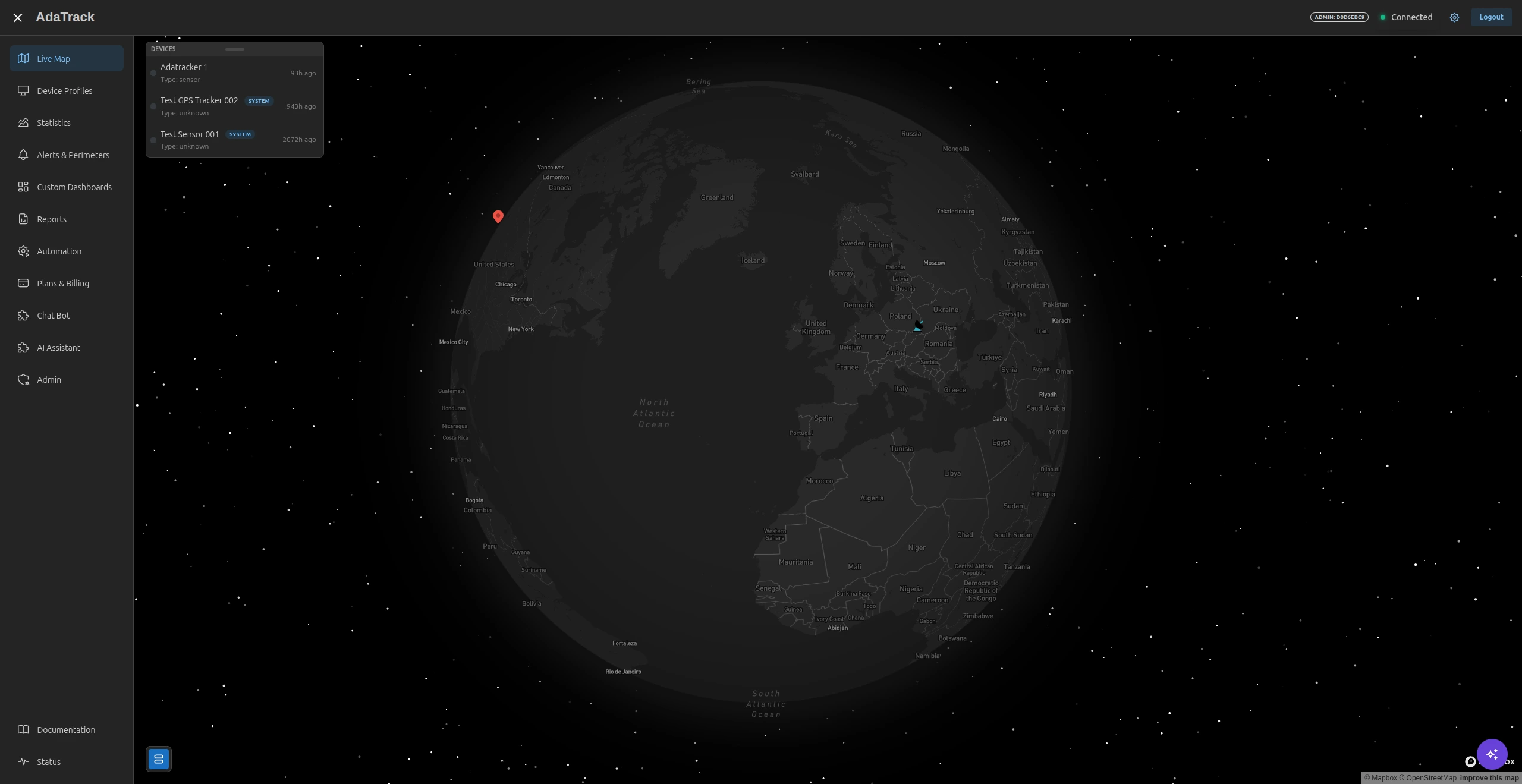
Real-time fleet visibility at any scale
GPU-accelerated WebGL rendering keeps your entire fleet live on screen — no lag, no page refreshes. Every location update flows from device to map in under a second.
- Sub-second device-to-map latency via WebSocket push
- Handles 10,000+ simultaneous asset markers with Deck.gl
- Smooth interpolated movement — icons glide, not teleport
- Historical breadcrumb trails with directional arrows
- Asset status indicators: Active, Inactive, Alert
Automatic Trip Detection & Travel Log
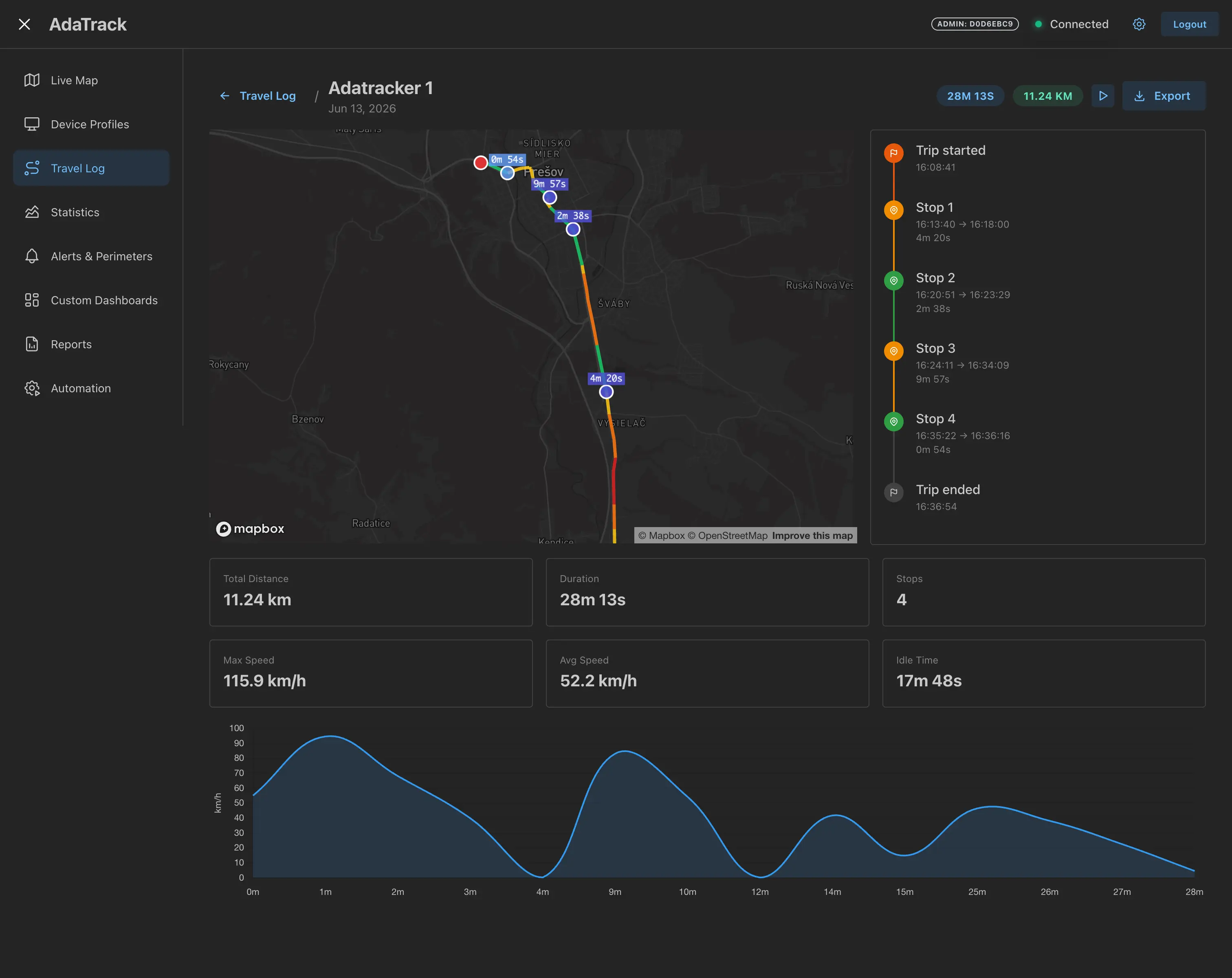
A per-device finite state machine runs inline in the UDP ingestion pipeline, turning continuous GPS streams into annotated trips automatically — no configuration required. Speed-gradient route maps, stop timelines, trip playback, and bulk export in CSV, GPX, and PDF.
- Zero-config detection: speed, duration, and distance triple-condition filter eliminates GPS jitter and false starts
- Speed-gradient polyline map — colour-coded green to red across every leg of the journey
- Scrubbable playback at 1×–32× speed with a live telemetry panel at the cursor position
- Export individual or bulk trips as CSV, GPX 1.1, or PDF via the built-in reporting engine
- Native Chat Bot commands (/trips, /trip, /tripstats) and AI Assistant tools for natural-language fleet travel queries
Draw zones. Get alerted the moment a boundary is crossed.
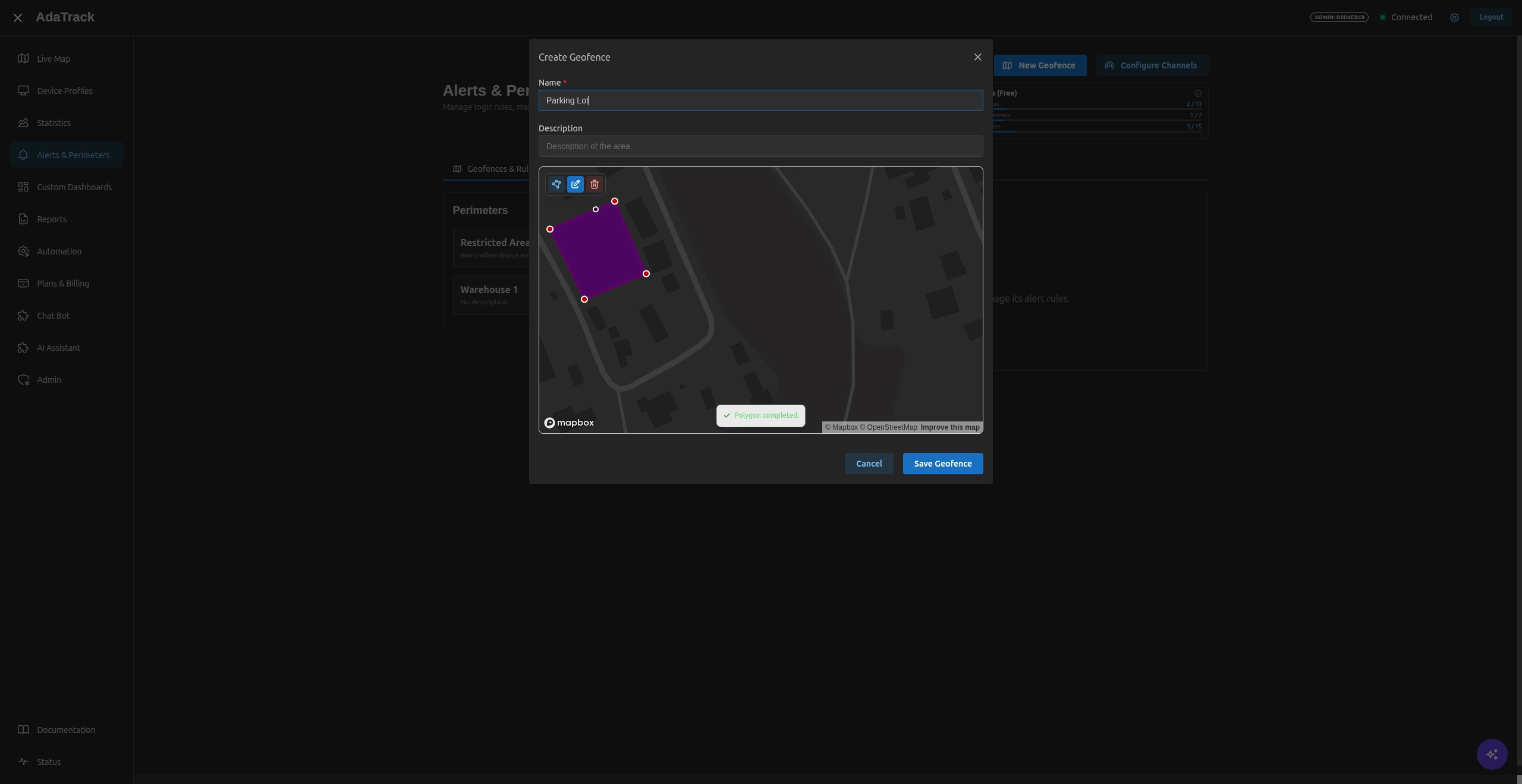
Draw virtual perimeters directly on the map and receive instant notifications when any device enters or exits. PostGIS spatial indexing handles thousands of active geofences without slowing ingestion.
- Polygon drawing tool directly on the live map
- Entry, exit, or both — choose your trigger direction
- Stateful tracking prevents alert storms on every update
- Apply to a single device or an entire Device Profile
- Sub-second evaluation on every incoming GPS coordinate
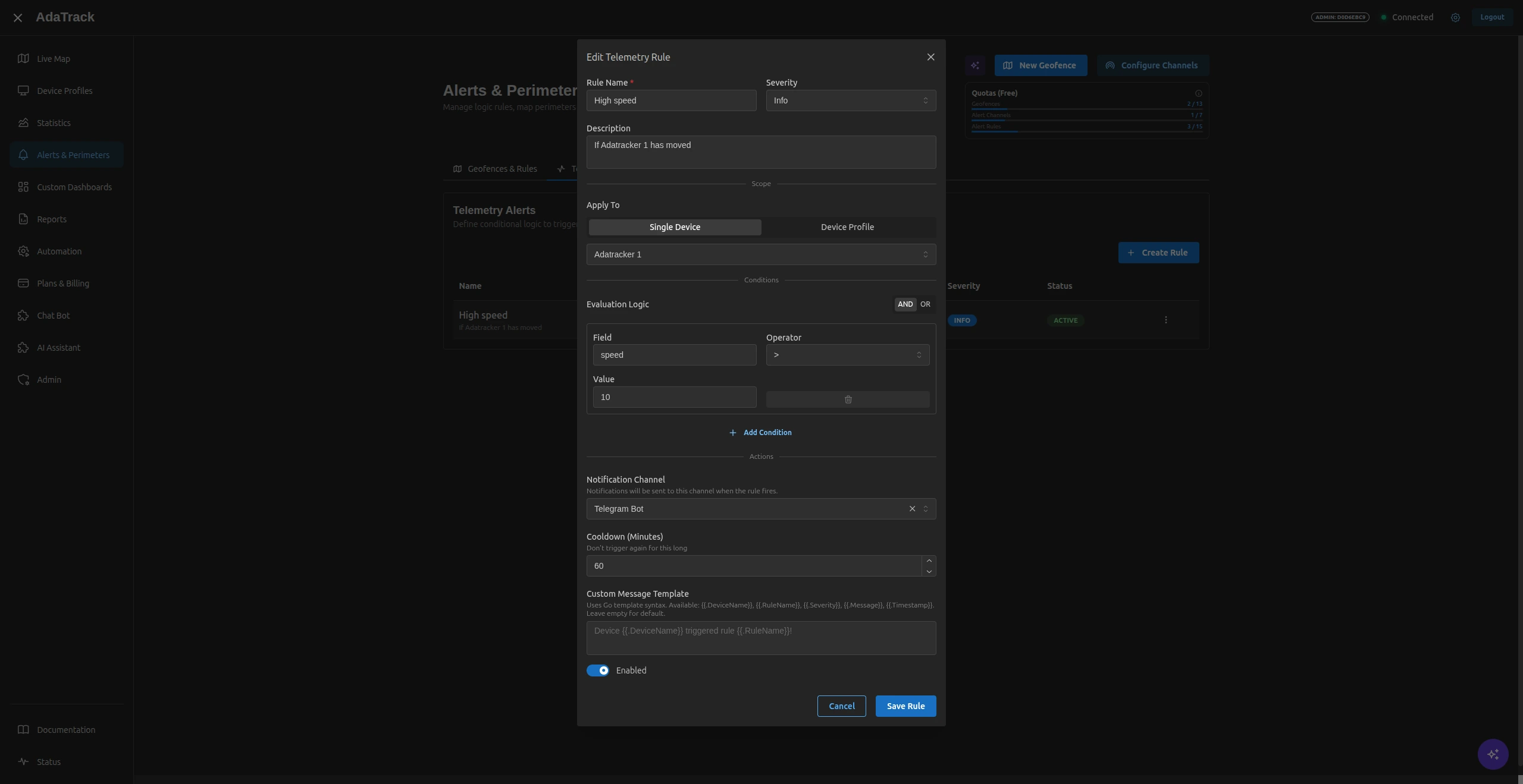
Complex rules, zero code
Define multi-condition alert rules with the visual rule builder. Combine AND/OR logic across any telemetry field your decoder produces — no scripting required.
- AND/OR logic with >, <, =, ≠, contains, exists operators
- Severity levels: Info, Warning, Critical
- Cooldown settings to prevent notification spam
- Dynamic field discovery from your device profiles
- Route alerts to Email, Slack, Telegram, or Webhooks
Scheduled PDF reports with maps and charts
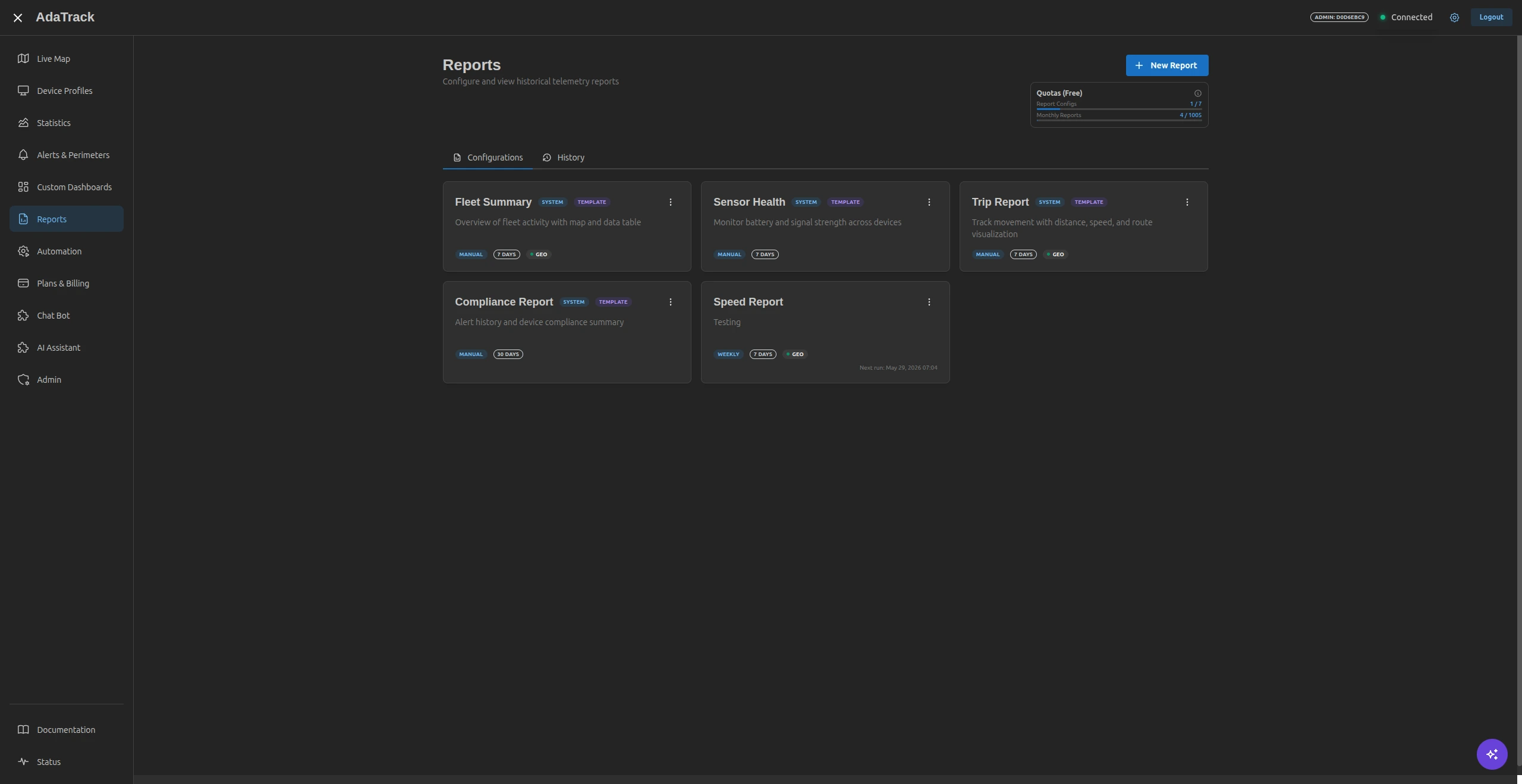
Generate professional historical summaries with embedded charts, route maps, and geospatial analytics. Schedule them daily, weekly, or monthly — delivered to your inbox automatically.
- Embed any saved chart configuration directly in a report
- Distance traveled, average speed, and idle time calculated automatically
- Scope by individual device or entire Device Profile
- PDF download, browser preview, or scheduled email delivery
- TimescaleDB aggregates ensure fast generation on large datasets
Visual automation — from telemetry to action
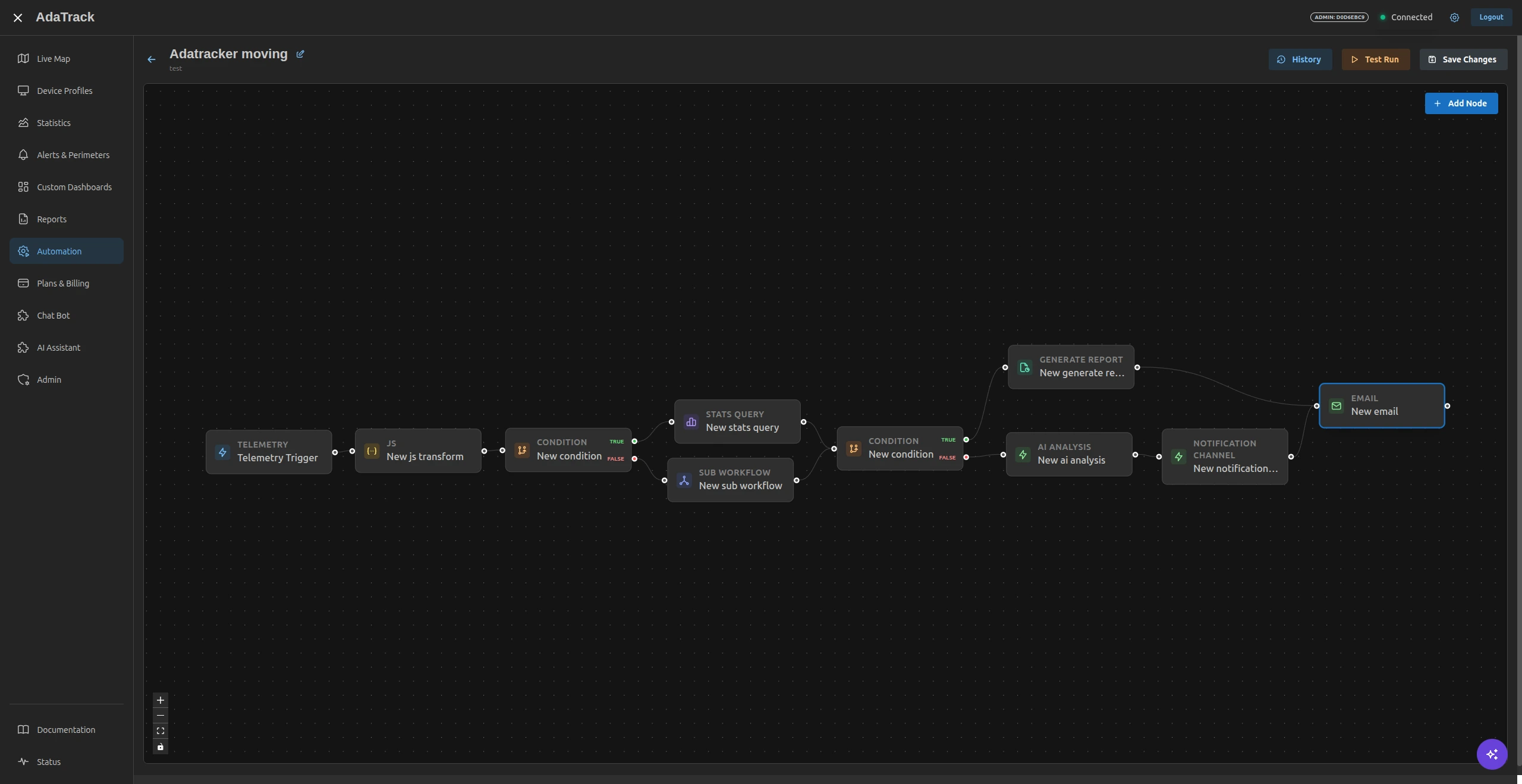
Drag, connect, run. Build event-driven automations that react to device data without writing backend code. Chain triggers, conditions, data transforms, AI analysis, and external integrations on a single canvas.
- 20+ node types: Triggers, Logic, Data, Actions, AI
- Triggers: Telemetry arrival, Geofence entry/exit, Scheduled (Cron)
- AI Analysis node — send telemetry to Claude with a prompt template
- JavaScript Code node with ES6+ and full variable access
- Live execution logs with success/failure history per run
Ask your fleet anything — in plain language
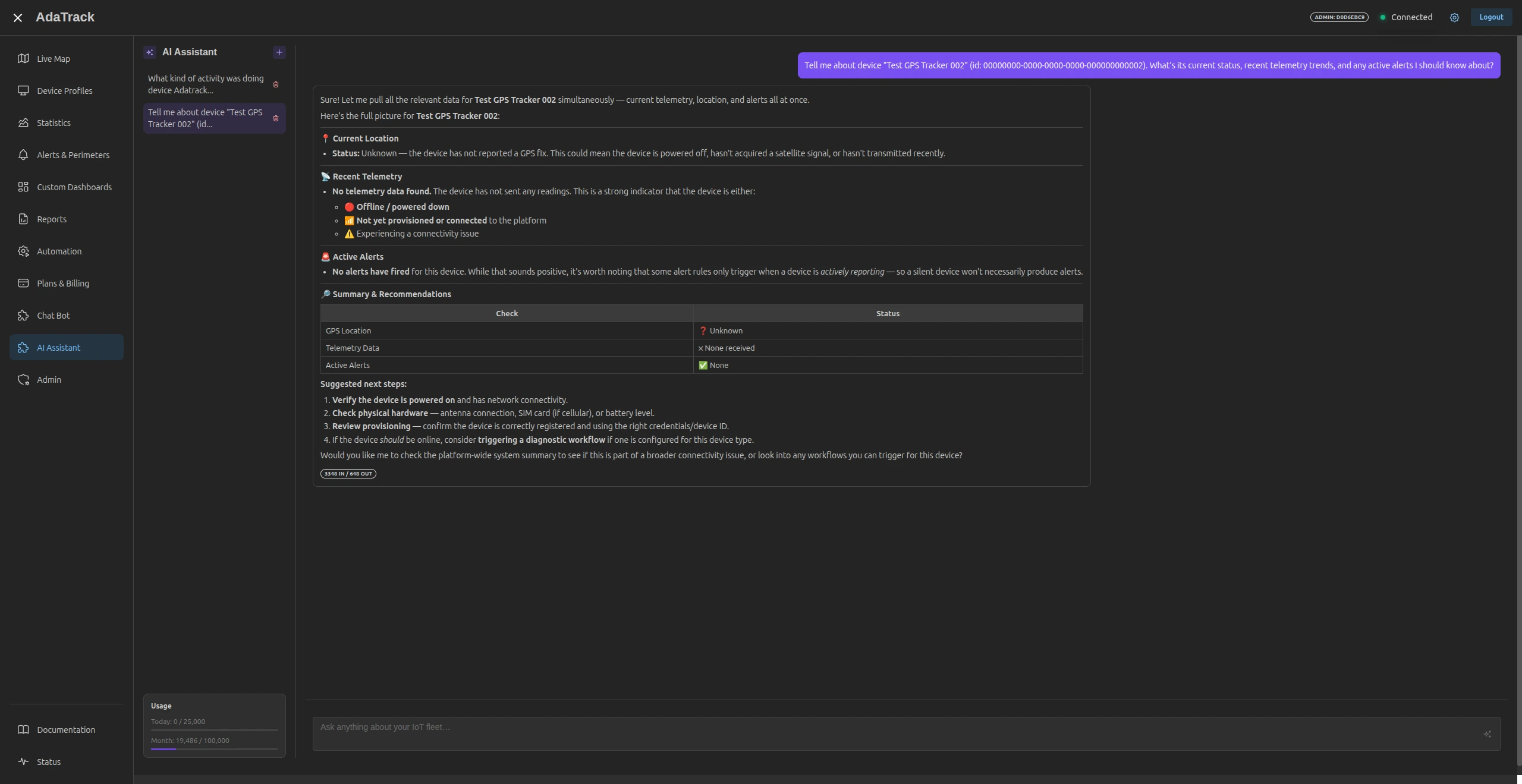
A floating chat interface powered by Anthropic Claude that understands your live device data, alerts, geofences, and workflows. Available on every page — no SQL, no dashboards required.
- Natural-language queries: "Which trucks haven't reported in 24h?"
- Context-aware — knows which device or page you're viewing
- Embeddable dashboard widget for contextual AI panels
- Workflow AI node for automated LLM-powered pipelines
- Provider-agnostic — default Anthropic Claude, configurable
Control your fleet from Telegram or Slack
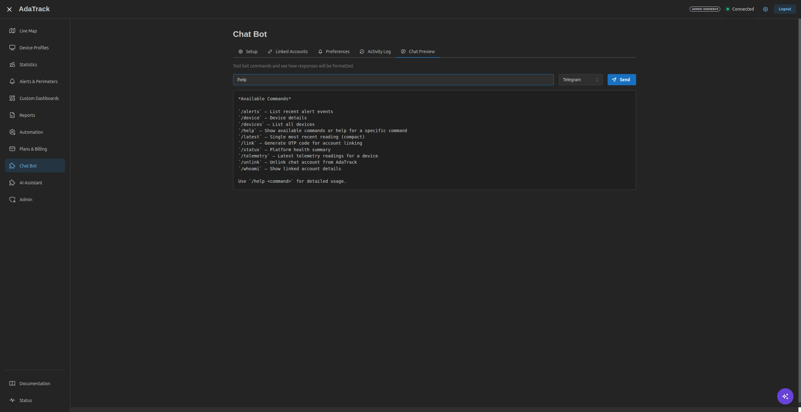
A bi-directional plugin that brings 10+ chat commands and interactive alert notifications into the tools your ops team already uses — no new apps to install.
- 10+ commands: /devices, /telemetry, /alerts, /status, and more
- Interactive alert buttons: Acknowledge, Mute 1h, Mute 24h
- Geofence transition notifications with entry/exit details
- Per-user notification preferences and quiet hours
- Secure OTP-based account linking (6-digit code, 10-min expiry)
Ready to see it live?
Start free — no credit card required. Or book a 30-minute demo with our team.